The new EURIS portal provides information on navigable waterways across Europe
15. 2. 2023Prague, 11 October 2022 – The unique website www.eurisportal.eu provides transport information on navigating waterways in 13 European countries. Official information on the navigability of Europe’s 17,000 km of inland waterways is now available in 11 languages, including Czech. Cruisers and skippers no longer have to go through a number of different websites, but can do everything in one place. They can also view the current location of their vessels across Europe and use a range of other services. The Czech Republic, through the Ministry of Transport, the Czech Waterways Directorate, the implementing organisation, and the River Information Services Manager of the State Navigation Administration, has been actively involved in the introduction of modern standardised digital services.
Within the framework of the RIS COMEX project, 13 European countries have jointly succeeded in introducing a single transport portal where all important information for navigation on inland waterways, referred to as River Information Services, can be found regardless of national borders. Its standardisation in the EU started as early as 2005, but it was not until the RIS COMEX project, launched in 2017, that the previously separate national information systems of the individual countries were linked and all information made available to the public on a single web portal www.eurisportal.eu. The Czech Republic provides data on 315 km of the navigable Elbe from the German border to Přelouč and on the Vltava from Mělník to Slapy. „The completion of the work on the COMEX RIS project, especially on its Czech national part, is a major contribution to the interconnection of the Czech LAVDIS RIS system with the newly established EU-wide RIS server, which will significantly facilitate a number of administrative and technological processes of waterway users.“ said Ing. Bc. Evžen Vydra, Ph.D., Director of the Water Transport Department of the Ministry of Transport.
Current water levels are crucial for the organisation of navigation. Now you can find up-to-date data from 776 water level gauges, including Czech control gauges, on a single website. Also published is the current underpass height under 89 bridges from all over Europe, with 7 bridges from the Czech section of the Elbe and Vltava. Anyone can subscribe to receive notifications of water conditions according to their own needs, which can be crucial for safe operation, proper transport planning and flood safety. Restriction information is issued via standardised „messages to skippers“ automatically translated into all languages. For the 2868 locks you will find not only their dimensions, but also operator contacts, operating hours and even automatically calculated average transit times. Information on 3,800 terminals and more than 11,000 berths is certainly useful for cruising. All official pan-European information is now also available in Czech.
A unique tool is the Cruise Planner, which allows you to plan your cruise itinerary across Europe, including average sailing times, operating times and lock contacts
and drawbridges, taking into account current navigation conditions and constraints.
For vessel operators, for the first time, current vessel positions transmitted by AIS technology are available in a single place from official national sources, even if one ship is on the Vltava and the other in the Netherlands, for example. The principles of commercial data protection are consistently observed, so that vessels of other operators cannot be identified, only their basic dimensions are shown. As a new digital service to waterborne customers, it is proposed that the vessel operator can make available to them information on the location of their cargo.
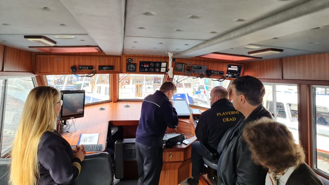
Modern River Information Services are not just about websites and services for vessel operators and logistics, but digital on-board systems in wheelhouses are an integral part of this. The current trend is to make all the necessary information available on a monitor in front of the vessel leader’s eyes. These systems display not only the waterway but also the position, name and other parameters of other vessels on a single Inland ECDIS electronic navigational chart base, using AIS, which often cannot be seen by the skipper because they are behind the river curve. This image can be combined with radar, which the skipper will appreciate in poor visibility. On the Elbe and Vltava rivers, similar to the Danube, the distribution and display of other important information such as fairway restrictions, lock closures, current water levels, underbridge clearances and even signalling on movable bridges has been piloted on the Danube using AIS technology, which works reliably independent of mobile internet coverage.
In addition, the EuRIS portal now offers free downloadable electronic Inland ECDIS charts for the whole of Europe.
The total cost of the 13-country project amounted to €26.5 million, of which €65 million in the Czech Republic. Of which 85% was financed by the EU Connecting Europe Facility CEF and the rest by the State Fund for Transport Infrastructure and the state budget.
In addition to the contribution to the implementation of the EuRIS common portal, the Czech Republic has made a complete modernisation of the technology for the processing of electronic nautical charts, reporting to skippers and AIS technology. Additional AIS coastal transmitters have also been installed, additional sensors have been connected on waterways and a single internal data bus has been introduced, including a new hardware solution for the EuRIS portal. Several service vessels were equipped with new on-board technology, two shuttle ferries on the Elbe with AIS equipment and some other technologies were introduced.
